Buying North Cape waterfront land can feel exciting right up until the real questions start. Can you actually build where you want, add a dock, install septic, and protect the view you paid for? If you are planning a custom waterfront build on North Cape, the smartest move is to understand the site before you fall in love with the house plans. Let’s dive in.
Start With Buildability
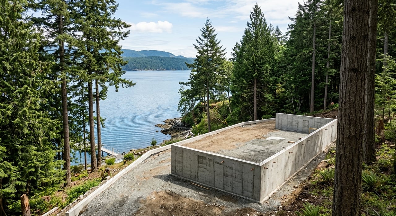
On a North Cape waterfront parcel, the first question is not square footage or finishes. It is the buildable envelope, meaning the part of the lot where a home, driveway, utilities, and related improvements can realistically fit.
Kootenai County’s site plan checklist requires key details to be identified early. That includes parcel boundaries, rights-of-way, easements, structures, utilities, roads and driveways, slopes, wetlands, drainage features, flood zones, and the disturbed area. On some lots, those constraints can shape the project more than the design itself.
If your access depends on a private road or crossing adjacent private property, an access easement is required. If the driveway is the first structure on the lot, Kootenai County also requires the exact driveway location to be pinned down.
This is one reason waterfront land can be more complex than it looks from the road or the dock. A beautiful site may still need careful planning to confirm where the home can sit, how you will reach it, and what site work is needed to make the lot functional.
Understand the Shoreline Boundary
North Cape sits along Lake Coeur d’Alene, which Idaho classifies as a navigable lake. Under Idaho’s public trust framework, the state owns the beds and banks below the ordinary high water mark, and the Idaho Department of Lands administers those lands.
That matters because your upland parcel and your lakeward use are not always the same legal question. In simple terms, owning the lot does not automatically answer what can be built at the shoreline or over the water.
Kootenai County parcel maps are helpful for orientation, but they come with an important warning. Shoreline depiction on those maps is for assessment purposes only, so you should not assume the mapped waterline is the legal boundary for docks, beach use, or setbacks.
A current survey is one of the most important early steps for a North Cape buyer. It helps clarify title, the actual shoreline relationship, and what space is truly available for improvements.
Know the Shoreline Management Area
Kootenai County’s Shoreline Management Area extends 25 feet landward in slope distance from the ordinary high water mark of recognized lakes. For Coeur d’Alene Lake, the county sets that ordinary high water mark at 2,128.7 feet NAVD88, which is equivalent to 2,128.0 in Avista datum.
Inside that zone, the rules are more specific. Fertilizer storage and chemical storage are prohibited, and mechanical ground disturbance is generally limited to permitted activities.
The code does allow certain improvements and uses, including limited stairways, walkways, trams, shoreline stabilization, pervious pavers, and some low-impact activities. In some cases, a Shoreline Management Plan prepared by a design professional is required.
If you are picturing a path to the water, erosion control, or carefully planned outdoor access, those improvements may still be possible. The key is understanding that shoreline work is regulated and needs to be evaluated early.
View Trimming Has Limits
Many waterfront buyers want to preserve a lake view while also respecting the land. Kootenai County’s shoreline code recognizes limited view-corridor trimming, but it does not create an unrestricted right to clear vegetation.
That nuance is important when you evaluate a parcel. If your vision depends on opening up a bigger view, you will want to understand what trimming may be allowed within the county’s framework before you assume the site can be cleared to match your plans.
Plan for Docks and Lake Improvements
If your project includes a dock, marina, shoreline stabilization, water line, or similar lake-related improvement, the Idaho Department of Lands encroachment permit process may apply. IDL also notes that some private uses of state-owned navigable waterways may require a submerged land lease or easement.
This is a major planning point for custom waterfront builds. A lot may have excellent shoreline frontage, but the process for adding or updating improvements at the water can still involve separate review.
For buyers, this means dock rights should be treated as a due diligence item, not an assumption. It is worth confirming what exists, what is permitted, and what the realistic approval path may look like for your intended use.
Boating Conditions Matter Too
Kootenai County imposes a no-wake zone within 200 feet of the shoreline, dock, pier, breakwater, or a person in the water. That may not change whether you buy a lot, but it can shape how the waterfront feels during boating season.
For example, no-wake rules can affect dock placement considerations, shoreline erosion concerns, and the experience of spending time on a deck or patio near the water. It is a practical reminder that waterfront living is not just about the view. It is also about how the site functions day to day.
Check Slope, Soils, and Wetlands Early
Waterfront parcels often come with topography that adds both beauty and complexity. On North Cape, slope can have a direct impact on design, engineering, cost, and timeline.
Under Kootenai County code, a conceptual engineering plan or geotechnical analysis can be required when slope reaches 15 percent or when there are unstable soils, shallow groundwater, or other risk indicators. If maps or soil data suggest wetlands may be present, wetlands delineation is also required.
This is where small or irregular lots can become expensive quickly. The land itself may trigger engineering and environmental work before construction drawings are even finalized.
If you are comparing parcels, a flatter lot with simpler access may offer a very different build experience than a steeper or more constrained site, even if both have strong lake views. That is why experienced waterfront buyers often evaluate the engineering path as carefully as the location.
Think About Sun and Orientation
A lake view is usually the headline feature, but orientation still matters. The U.S. Department of Energy notes that south-facing windows capture more winter sunlight, while east- and west-facing glass can bring more glare and summer heat.
On a North Cape build, that creates a design balancing act. You may want to frame the water view while also thinking through daylight, seasonal comfort, and shading.
This does not mean there is one right orientation for every lot. It means the best custom homes tend to respond to both the view and the sun, rather than treating the floor plan as something that can be dropped onto any parcel.
Confirm Septic and Well Feasibility
If the parcel is not served by a suitable existing system, utilities can become one of the biggest unknowns. If septic is part of the plan, Panhandle Health District permits and inspects septic systems and can conduct site evaluations.
Idaho DEQ advises getting that site evaluation before purchasing property. That is practical guidance for any waterfront buyer, because septic feasibility can directly affect home size, placement, and development cost.
If a well is needed, Idaho Department of Water Resources requires a drilling permit before construction and requires a licensed driller. Kootenai County planning also directs septic questions to Panhandle Health and community water system issues to DEQ.
In other words, utility planning should happen early, not after design decisions are locked in. A parcel that looks straightforward at first glance may still need careful coordination to confirm wastewater and water supply options.
Review Flood Risk Before Design
Flood risk is another issue that should be checked at the very start. Kootenai County points buyers to county flood hazard resources and the FEMA Map Service Center to determine whether a property is in a special flood hazard area.
That status can materially affect grading, fill, insurance, and building strategy. County floodplain standards also require compliant fill, erosion protection, and permits for watercourse work in special flood hazard areas.
For a custom build, floodplain review is not just a paperwork step. It can influence where the home sits, how the site is graded, and what the budget needs to account for.
Build the Right Team Early
A build-ready North Cape plan usually involves more than a builder and an architect. Depending on the parcel, you may also need a county planner or building reviewer, surveyor, civil engineer, geotechnical engineer, septic designer or installer, well driller, and Idaho Department of Lands staff if shoreline encroachments are involved.
Kootenai County’s preliminary approval process begins with a sketch plan and planner review of feasibility. County code also specifically contemplates design professionals for geotechnical and shoreline management work.
That is why waterfront lot purchases are often a sequencing exercise. The most important questions are usually hidden in the site itself, including the exact ordinary high water mark, easements, slope, flood zone, septic feasibility, dock rights, and the true permitting path.
A Smarter Way to Evaluate North Cape Land
If you are planning a custom waterfront build on North Cape, try to think like a project manager before you think like a designer. The goal is to understand what the land can support before you invest too much energy into plans that may need to change.
A strong early review typically includes:
- Current survey review
- Easement and access review
- Site plan feasibility
- Shoreline management constraints
- Dock or encroachment permitting questions
- Septic and well feasibility
- Slope, soils, and wetlands review
- Flood hazard check
When those pieces are understood upfront, you can move forward with more clarity and fewer surprises. That is especially valuable on waterfront property, where the setting is extraordinary but the rules are often layered.
If you are weighing a North Cape lot or trying to compare a few options, local insight can make the process much more efficient. For tailored guidance on waterfront parcels, buildability questions, and the North Idaho lakeshore market, connect with Griffin Realty Group.
FAQs
What makes a North Cape waterfront lot buildable?
- A buildable lot needs a workable envelope for the home, driveway, utilities, and site improvements, while also accounting for easements, slope, wetlands, drainage features, flood zones, and shoreline rules required by Kootenai County.
Does a North Cape parcel map show the legal shoreline boundary?
- No. Kootenai County’s parcel maps state that shoreline depiction is for assessment purposes only, so a current survey is important before relying on the mapped waterline for setbacks, beach use, or dock planning.
Do North Cape waterfront lots fall under Idaho Department of Lands rules?
- Lake Coeur d’Alene is a navigable lake, so Idaho Department of Lands administers the state-owned beds and banks below the ordinary high water mark, which can affect docks, shoreline work, and other waterward improvements.
Can you add a dock to a North Cape waterfront property?
- Possibly, but you should confirm the permitting path first. A dock or similar lake-related improvement may require an Idaho Department of Lands encroachment permit, and some uses may also require a submerged land lease or easement.
What is Kootenai County’s shoreline management area on Lake Coeur d’Alene?
- It is the area extending 25 feet landward in slope distance from the ordinary high water mark, where certain storage, disturbance, and improvement activities are more tightly regulated.
Should you test septic feasibility before buying a North Cape lot?
- Yes. Panhandle Health District permits and inspects septic systems and can conduct site evaluations, and Idaho DEQ advises getting that evaluation before purchasing property.
How can slope affect a custom waterfront build on North Cape?
- If slope reaches 15 percent, or if unstable soils, shallow groundwater, or similar risks are present, Kootenai County code can require a conceptual engineering plan or geotechnical analysis, which can affect cost and timeline.
Why should flood risk be checked before designing a North Cape home?
- Special flood hazard status can affect grading, fill, erosion protection, insurance, and overall building strategy, so it is best reviewed before finalizing the site plan or home design.